South Pole aerial views and site plans
|
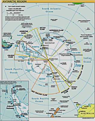
The map above is no match for the 1:5,000,000 hard copy that used to be hanging on my wall, but it is a fairly decent political map brought to you by the US Central Intelligence Agency. Here's a better larger PDF map I've found...brought to you from those folks at the Central Intelligence Agency--yes, they DO share some of their information publicly. Here's the CIA's factbook page about Antarctica. Now as for Pole...
By the way, the best generally available hard copy Antarctic maps are the ones published by the British Antarctic Survey and the National Geographic Society. I've got the 1975 National Geographic map on my wall, it's not one of the ones they list for sale now. These and other maps used to be available from the folks at the Antarctic Connection, which, alas, is no longer around. |
