Through the Pole Soul era...1976-1983
|
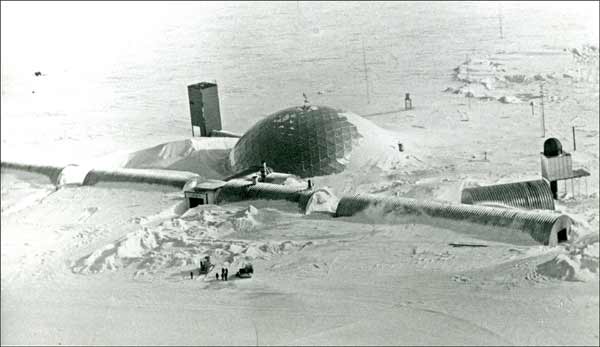
In 1976, it was long before some of the items in the more recent satellite and aerial photos had been buried...or even created! We obtained copies of these 3 aerial shots from the Navy...then as now NSF wanted photo coverage of the station condition and snow drifting, so very early in the summer season they sent a photographer (PH2 Jolin) down to get some high-resolution coverage of the station and the snow drifts. Dan Morton and the '76 w/o crew had been plagued with several severe storms during October, and as a result they spent much time reworking the skiway instead of clearing out around the station. Oh yes, I'm one of the folks standing out by the 955 forklifts and watching this plane. Don't ask me which one I am... The CARA website is an excellent source of newer maps and views of the domed station. This is the direct link (archive) to their overall site plan, part of their virtual tour. This page also features the famous 1983 USGS large-scale aerial photograph seen below. At that point in time the station still looked much as it did when we left it... 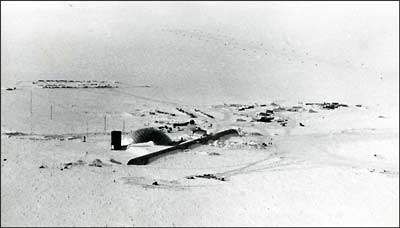 This is a view from an unusual angle--looking grid southwest at the station from inside the clean air sector. The D4 in the foreground is preparing the foundation pad for "new clean air," and some of the construction materials for that structure are staged nearby. The entrances to the buried "old" CAF, and its science field, are just to the left of the fuel arch. At the other end of the station, above and to the right of the garage arch is the new summer camp site, and beyond that is the old construction camp where the fire was. Beyond that is the skiway; if you extend the line of the runway markers up and to the left you will come to the shadow of 917 at the top of the photo. 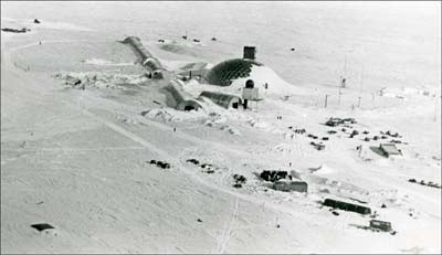 Here's the view from downwind of the station. Near the bottom right, the long structure is the new summer camp head/galley Jamesway that replaced the one that burned down. At this point it is still under construction; eventually our berthing Jamesway would be connected to the lower right end. Below the Jamesway is a wanigan (sled-mounted hut) which the construction crew used for work space and storage. The other structures in the area are the original construction camp garage, which was turned into the summer camp/emergency power plant; and two shop Jamesways which were cleaned out and used for berthing. At the lower left of this picture is our emergency DFA fuel storage bladder. 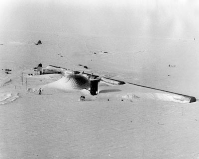 Another view, of the skylab side of the dome. This photo wasn't part of our year--it was taken after we left, during the 1977-78 summer. The cosray detector platform erected in 1976-77 is in the foreground; in the background is GCA and the skiway. One can clearly see that the drift we'd been watching had finally started to envelop Skylab (thanks to 1978 w/o Kevin Bisset for sharing this photo). 
This small-scale site layout came from the 1977 station operations manual. 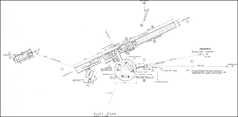
An updated scan from my copy of the dome construction drawings. The circled letters represent drawing revision numbers...no longer relevant, while the hexagons depict the building numbers. As many of you will recognize, geomag, seismo, and cosray didn't end up where they are depicted here. As for the emergency camp (building 7), it obviously never happened. Two of its four modules were turned into the annex, and I stumbled upon a third module (sans emergency generator it was to have housed) on the hillside behind McM after my 1977 winter. Here is a larger version (875 kb). 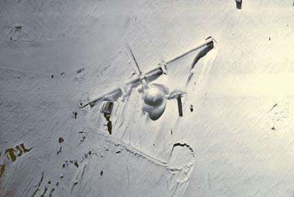
Here is a good 1978 aerial shot directly over the dome, from the NOAA archive credited to 1979 winterover John Bortniak. I've given up trying to adjust the color so my edited version is almost black-and-white, but there is a lot of detail, and the shadows from skylab, BIT and clean air are very pronounced. 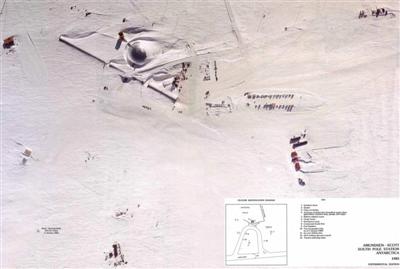 In 1983 USGS shot several aerial photomaps, including this famous one of Pole which was taken on 31 December 1983. CARA's link to this image (archive) also includes a large image; this is the direct link to a 2928x1973 image file (744kb). But...these photos do not include the entire poster. 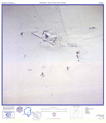 Allen Cull HAS scanned the entire poster. Although it is not on his new web site, I have a smallish copy you can look at here (744kb). The hard copy of this poster used to be available from the now-defunct Antarctic Connection store...but it is still available for purchase from the USGS for only $10. Or it is online...took me a dozen tries to download it from the USGS site, so I'll save you that trouble and you can download it from my site (warning--62mb). Perhaps the USGS doesn't realize that if you look closely between the two tractors chaining the skiway, this aerial photo depicts the late Bob Hurtig mooning the aircraft...along with George Cameron wearing Big Red...as documented here (the 2400 dpi closeup of the activity). USGS was scheduled to take a new version of this image in 1988, but the specially equipped aircraft (131) crashed tragically at D59 before this took place. next map page | map index |