Old and, well, older looks at Old Pole
|
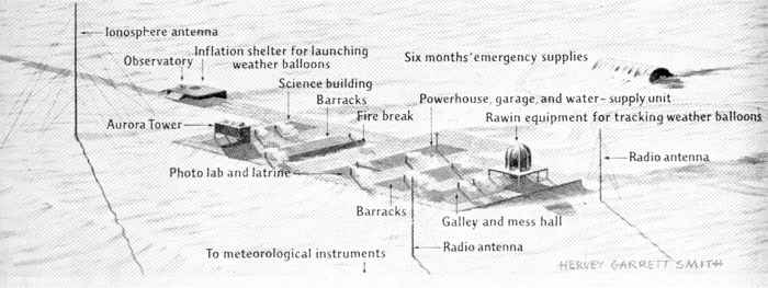
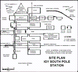
Above, the original plan for the station, as adapted from the drawings in the back of RADM Dufek's book Operation Deep Freeze. (This version is courtesy of Scott Smith, the intrepid Pole plumbing foreman and philatelist.) Due to the vagaries of airdrop and the foresight of Dick Bowers, Jack Tuck, and Paul Siple, the place actually turned out much nicer... The graphic layout below by Hervey Garrett Smith (© 1957, National Geographic Society) shows how it actually happened...a version of this was published in Paul Siple's book 90° South with the pages reversed, and it also appeared in the July 1957 National Geographic magazine. This view is looking southeast.
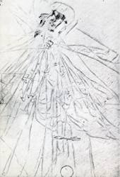
The photo at right above (full size) was taken around the same time by photographer Marion Beebe, only the 39th person to reach the Pole (photo from The White Desert by Noel Barber; © 1958 by Noel Barber...Noel covered the Hillary-Fuchs Trans-Antarctic Expedition and was another of the first few media people to reach Pole).
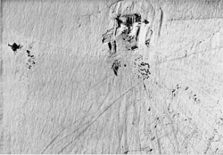
This map (right) from Sid Tolchin, 1959 OIC, shows how the station actually turned out. Since all of the Antarctic stations were originally designed for only a limited lifetime during the IGY period, 1959 was scheduled to be the year everyone went home by March. After the decision was made to make the ice presence permanent, the first effort to do additional construction had to be made at Byrd which was rapidly becoming crushed by the snow load. 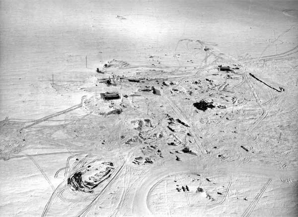 Above, a 1961-62 aerial photo from Richard Barnard. His description: This aerial view is looking east, the roof of the new comms building is visible in the left center foreground.. Just south of the new building are the furnace stacks of the already-buried sickbay and enlisted barracks which had been built in 1959-60. 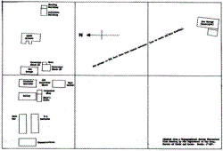
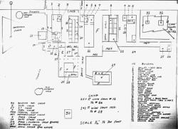
The map at left shows the station as of March 1962--it was drawn to show the location of the garage that burned down in October 1964, so grid north is to the left. Since the Jamesway between the original garage and the science building is gone (and has not been replaced yet) the future Club 90 building is still being used for berthing. The grid squares are approximately 200 feet on a side (Bulletin of the U. S. Antarctic Projects Officer, December 1964). 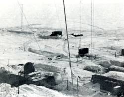
At right is a January 1964 aerial view from partway up the new forward scatter antenna tower. This view looks northeast; at left is the dug out area next to the galley where the steel rigid frame roofing is being installed; to the right of the two Jamesways is the end of the newly constructed #2 fuel cache. The dark square structure in the center background is the cosray building, also new this year (photo by aurora w/o Henn Oona, from the Bulletin of the U. S. Antarctic Projects Officer, Summer 1964). Below, an aerial photo taken around the same time (7 Februrary 1964) looks west, here more of the exavations can be seen, including the new corrugated steel seismo tunnel (U. S. Navy photo courtesy Mike Davis). 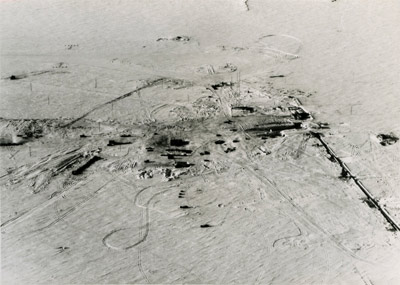 |
  |
|
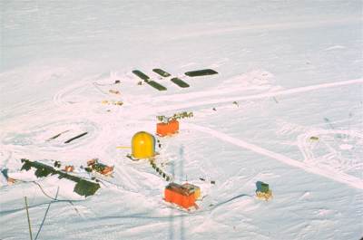
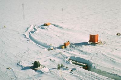
The above two 1965 photos were taken by Steve Kauffman from the forward scatter antenna. The view at left looks toward the skiway with the GCA radome in the center, the orange TACAN behind it, and the GCA control module in front behind the antenna shadows. In the background are some of the bladders used to receive DFA before it is pumped to the fuel caches. The right view shows the main part of the station. The builders' tunnel arch is visible; behind it is the aurora tower and the balloon inflation tower. Cosray is in the background. 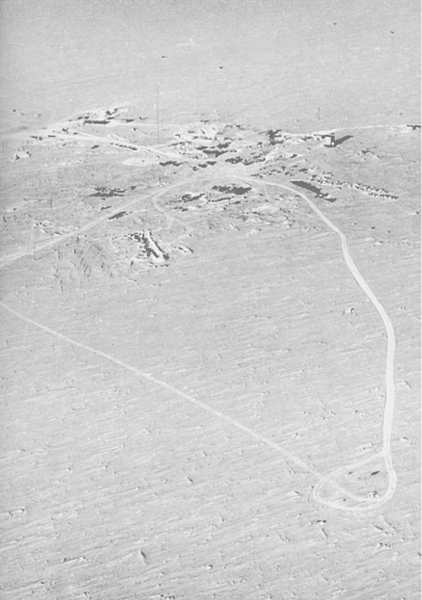
The photo at right was one of a series taken for NSF on 15 February 1965. This view is looking almost north, the station is near the top of the picture, and in the background the skiway angles up to the right with several runway markers visible (remember the original skiway is on the west side of this station). The forward scatter antenna (from where the above color photos were taken) is barely visible just to the left of center; to its right is the GMD dome (large dark structure) and to the right the white rectangle is BIT. The area inside the graded loop in the lower right appears to be the geographic pole--this location is somewhere near the present MAPO. This means that the lower 3/4 of the area you see here will be explored in depth as it were by the IceCube drillers over the next few years...fortunately any of the stuff that may still be there is fairly shallow so that it would be found by the shallow firn drill and not the big guy. Yes, there is an extra large version of this photo here...  The U. S. Navy site plan at left is from the 1966-67 season--quite well indexed and large enough to show some of the outlying facilities. This drawing is from Support for Science Antarctica, by the History and Research Division, U. S. Naval Support Force, Antarctica; fourth edition printed February, 1968. Of course things show up much better in the full size view. 
The map at right is also from 1967, it is contained in a one of a volume of papers by the "sleep" studies folks... Shurley, Jay T., Physiological Research at U. S. Stations in Antarctica, University of Oklahoma Health Sciences Center; published in Human Adaptability to Antarctic Conditions, American Geophysical Union Antarctic Research Series Vol. 22; Gunderson, E. K., ed., 1974. 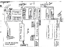
The other side of the tracks....er...skiway as we found it in 1976. This is a fairly accurate look at Old Pole as it was when it was turned off in February 1975. I've attempted to restore some of the damages done to this by our infamous copy machine. And we made many copies of this, which was informally called the tourist map, since this historic place was still open to visitors. The grid north arrow is 10° to the right of vertical. The front door of the dome is about 3/4 mile southeast of here. 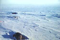
This is an unusual low aerial view of the old station from 1976-77. The camera is north of the station (looking "down from the top" of the above site plan), with the lens pointed at about grid 205°. The "NCEL Jamesway" in the foreground housed the original experimental Rodriguez (potable water) well which operated for awhile in 1972-3. The main part of the buried station runs from the lower left up diagonally toward the middle right. The science building and its aurora tower (skylab) are off camera to the left. Looking straight back from the NCEL Jamesway are the stacks of the power plant, the garage, and another Jamesway used as a temporary garage. At least that is what I see from here. 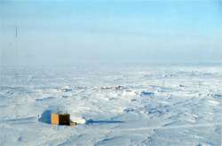 At left is another aerial view; this one I cannot identify, but I'm guessing the wood structure is one of the gravity vaults located along the seismo tunnel. At left is another aerial view; this one I cannot identify, but I'm guessing the wood structure is one of the gravity vaults located along the seismo tunnel.I suspect these pictures were taken using a long lens which has distorted everything. I'm open to corrections. These are copies of copies of..uh, I really have no idea where the original slides came from. We had an antenna crew around for awhile, salvaging some of the old towers. They may have taken pictures, or these may have been taken from an aircraft. 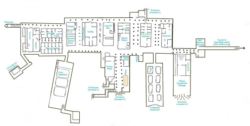 Here is a more recent computerized map of the place prepared by one of the w/o's a few years ago... next map page | map index |
