2012-13 Photos - Old Pole remediation (continued)
|
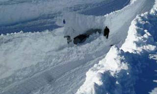
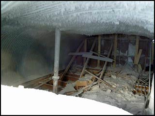
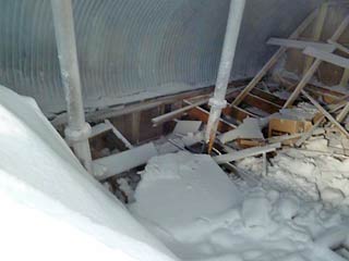
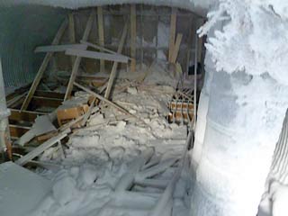
So...what are we looking at above? A void that was found during the YETI investigation of Old Pole
in 2011-12...so it got excavated as seen here, and filled in. That's the short version (JL PTC 2013). 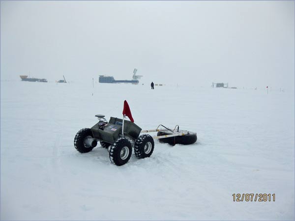 YETI, seen above (JL), is a 150-pound articulated robotic device developed at Dartmouth (for more information and links about it, see this page from the 2011-12 season). Anyway, in the above photo, it is towing ground-penetrating radar (GPR) above the Old Pole site, as you can see if you know the geography. It was investigating the results of the 2010-11 efforts to collapse the old station, to determine if more remediation would be necessary. So what did they find? 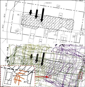
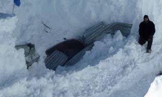
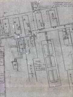
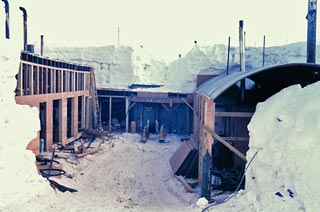
The top part of this graphic at left (JL PTC 13) is the "before" image of the planned scans...the area of the hashed lines is the main part of the station which was collapsed with those explosives, and the large black arrows denote possible directions of backfill should that have proven necessary. The bottom portion of the graphic depicts the actual routes of YETI as it traversed the site. The two areas of concern are marked in red. One area at the east (right) end of the main station area involves buildings 13 and 21 (the balloon inflation building and the met storage building/ former hydrogen generator building respectively) which is a relatively small area. The other area (also shown enlarged in the lower left corner of the graphic at left) involves building 10--a small At right is a partial view of the area of concern which identifies all three of those buildings/rooms (from my 1974 blueprint; here is a more recent drawing created from that blueprint). So...in 2012-13 it was decided to excavate that area. The two photos at the top of this page depict the dug-out south end of buildings 34/10/33...or at least an opening into the corrugated steel "top hat" above them. And that is Martin Lewis inside the excavation. Needless to say, all of this got me quite curious. So I dug into some older portions of my web site and discovered the photo at left, which was taken in 1967-68 by NOAA guy Fred Walton. It is looking north at the builder's tunnel from about the location of the letter P in "POL" in the blueprint above...needless to say the entire area had been excavated to do major repairs to the power plant on the left side of the tunnel area. On the right side of this photo is building 11, which is variously labeled "night shift quarters" or "ASA quarters" (and earlier there may have been a head here). The power plant was replaced by the smaller buildings 10/34/33, and the central portion of the builder's tunnel was roofed by a corrugated steel arch supported on timber columns. And presumably buildings 10/34/33 were also covered over by a corrugated steel "top hat" similar to the one above building 11. Below...some views looking north inside the excavation opening...apparently this is a top hat above building 10. The power plant in the above photo did NOT have a corrugated steel arch roof (here is what the power plant roof looked like in 1967), so presumably that arch top hat was added later after the power plant went away. | |
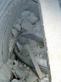 I'm not sure where this was taken; apparently we're looking toward a previously collapsed arch section. This reminds me of the snow blocks and rubble at the collapsed module end of Siple 1 in 1988. | |
|
Above, two more views of the open void above the old roof.
So what comes next? One plan which may happen is to collapse this area using explosives. Perhaps the builder's tunnel arch will collapse at the same time. Here's a link to one of my Old Pole pages which includes another photo of the power plant, credit for these NOAA photos, and a discussion of them by the photographer. So what has YETI been doing more recently? In 2012-13 it was used to explore the ice caves near the summit of Mt. Erebus, as documented in this 1 March 2013 Antarctic Sun article, this NSF press release, and this Dartmouth YETI blog which also describes the earlier Pole explorations. In 2013-14 the plans were to have it explore the Shear Zone...a continuing severe crevasse area on the northern Ross Ice Shelf along the South Pole Traverse route. Other credits and links and thanks...the images denoted JL PTC 13 are credited to Jim Lever of CRREL and Dartmouth, they are from a paper presented at the 2013 Polar Technology Conference. (Also of interest is this short AVI video of YETI in action over Old Pole). The large photo of YETI denoted JL was provided to me by Jim Lever. The first photo looking into the top hat is from Martin Lewis, who also explained to me what was depicted and what was planned. The other 3 photos are from Matthew Andler. | |
