2010-11 Photos - Urban Renewal III--Old Pole is gone
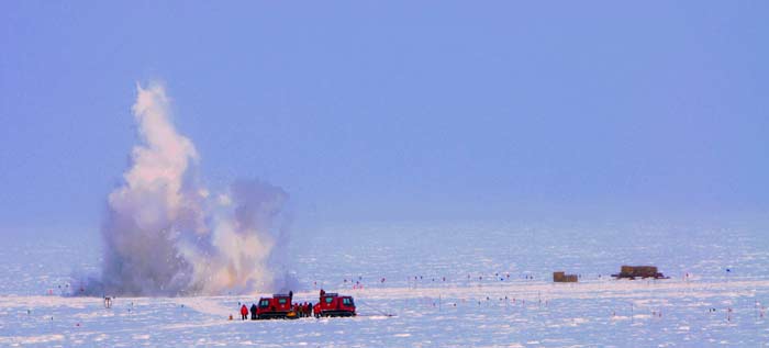
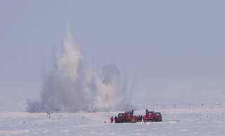
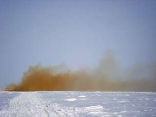
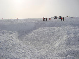
After the unfortunate events of last season, the planners at RPSC, NSF and CRREL went back to the drawing board as it were. NSF finally decided that the best solution was to permanently remediate the area by imploding it. Most of the station had been constructed of "T-5" structures...put together with prefabricated preinsulated panels (plywood on each side with an internal insulation layer) and over the years as they got deeply buried they were covered over with "top hats"--uninsulated 2x4 framed "attics" intended to protect the building roofs from the weight of snow. Some of the buildings ended up with two layers of these...essentially big air-filled voids under the snow...not safe things to drive heavy vehicles over. | |
|
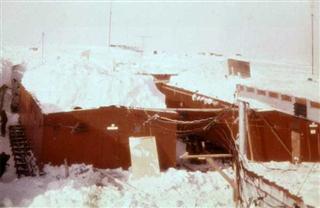
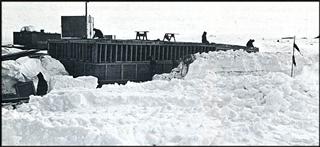
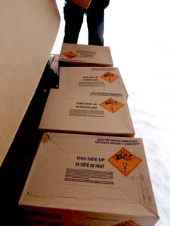
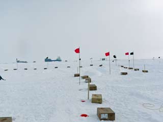
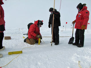
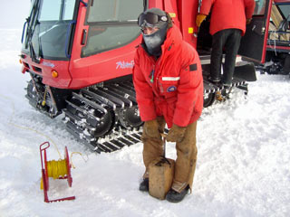
The left photo above looks west-northwest from near the south entrance to the galley (right foreground) at the enlisted barracks (left center) and sickbay (right), before they had any top hats. These two buildings were constructed in 1960-61; this photo was taken three years later when the structural steel roof was installed over the open area, and it gives a good idea at how quickly the station was getting buried. The communications building (into which the Challenger fell in January 2010) is behind the two buildings (photo from Ron Lampert). The decision had been made to implode the buildings below the snow surface...and to insure safety, to complete this effort without having anyone enter the buried station. John Rand, a consulting engineer with the U. S. Army Cold Regions Research & Engineering Laboratory (CRREL), was a major participant in the planning, as John is one of the few people in the program who has worked in the old station as well as the Dome and the present elevated station. The project began at the beginning of the 2010-11 season, with a ground-penetrating-radar scan of the area conducted by a CRREL team. The building corners were flagged on the snow surface, and the dangerous areas were identified. Meanwhile the explosives were shipped in (right)(MM)...more than 7600 pounds of Dyno Nobel Exgel 75 3x16 dynamite. The general area to be remediated was approximately 100 x 300 feet. Working roped together for safety, the blasting team borrowed a hot water drill from the IceCube project to drill 20-40 foot holes every six feet around the outside perimeter of the buildings. The holes were drilled down until they hit the roof of the passageways/tunnels surrounding each building; thus the bottom of each hole was roughly even with the original roof of a building, at the bottom of its top hat structure. Each hole was loaded with dynamite and detonation cord up to within one foot of the top of the top hat structure; the remainder of the hole was backfilled with compacted snow. | |
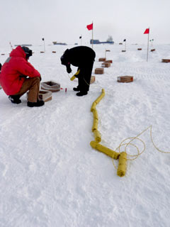 The dynamite strings are being laid out (MM)... |
|
| |
Or...you can watch this video from summer help desk guy David Pablo Cohn! | |
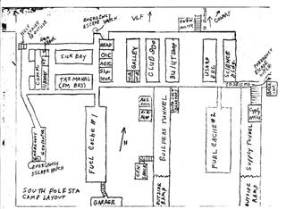 What was destroyed...as depicted in our 1976-77 map. The 9 major buildings are obvious here in the main station (north/top half of map). (the rest of my Old Pole map collection). |
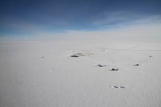 The aftermath as viewed from above...the craters in the foreground are visible in this 3 February aerial photo by Robert Schwarz (Antarctic Photo Library). |
|
The major credit for this page is this Antarctic Sun article by Peter Rejcek...with the major contributor to that article being lead explosive handler John Horgan. As for the photos...several are from Marie McLane; others were grabbed from the common drive and posted in blogs by several of the 2010-11 Polies. Other things were going on in the dark sector...the beginnings of the Askaryan Radio Array. | |
