2011-12 Photos - Looking down on Old Pole
|
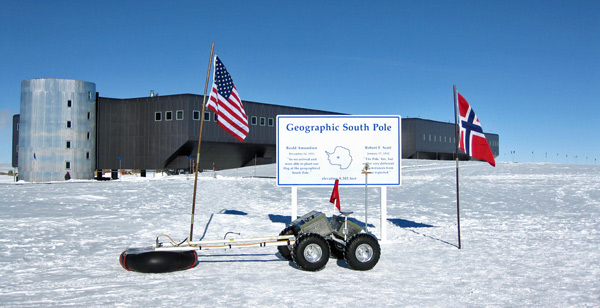
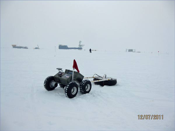
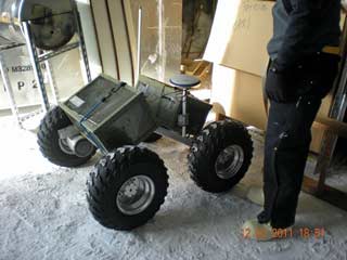
Above is a hero shot image of Yeti (JL/NSF)...a small articulated robotic device that was used to deploy GPR over the Old Pole site. It weighs about 150 pounds not including the GPR...it was originally developed at Dartmouth University's Thayer School of Engineering, with some CRREL involvement. The robot project began in 2005, and this current evolution was created starting in 2008. Yeti (not an acronym for anything) has been tested and used to survey crevasses on the Greenland Inland Traverse (GRIT) route and the South Pole Traverse (SPoT) route. It was brought to Pole to see if there were still any significant voids in the area of the buried station that needed engineering attention. Here it's at work in the dark sector above Old Pole (JL); DSL and the SPT are in the background. Yeti can be controlled in a tethered mode, but untethered with a 48 volt battery bank it has a 3-6 hour or 4-1/2 mile range. It is equipped with a radio and GPS link and can follow a waypoint course. More advanced tasks involve "learning" to evaluate and process crevasse images based on previous experience. | |
| What were the findings? Well, despite the blasting operations in 2010-11, Yeti still found a few voids down there...not the top hats in the main station (which had been the previous focus of remediation). One area of interest was the central area between the galley and the sickbay/Taj Mahal, which had structural steel framing erected in 1963-64. Here us a fairly recent file photo of the area looking south, the OIC/store building is at left and sickbay is at right). The other areas with apparent voids were the small met storage and BIT structures at the east end of the station, and an area in the builder's tunnel on the south side of the station. As of June 2012 the planning was still underway on what to do. Then, in 2012-13, the builder's tunnel area was dug out as documented here. | |
|
The first part of this NSF video includes a description as well as views of Yeti in operation. More information about Yeti and the project...most recently, during the 2012-13 season it was used to sense out the unique ice caves near the crater of Mt. Erebus (1 March 2013 Antarctic Sun article and NSF press release). The NSF press release was the source of the top photo on this page. Coverage of the 2011-12 Old Pole survey includes this Antarctic Sun article. Here's a July 2011 article in The Dartmouth, as well as a blog by the robot development team. The first four photos seeb above are from Jim Lever (JL) of CRREL (and Dartmouth), I first saw most of them in presentations by Jennifer Mercer (CRREL) and Rebecca Williams at the 2012 Polar Technology Conference in Fairlee, Vermont, close to the Hanover, NH institutions. The other photos are from Polies on station, unattributed by request. | |


