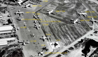
The VX-6/USARP Hangar
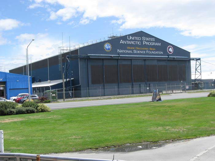
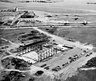
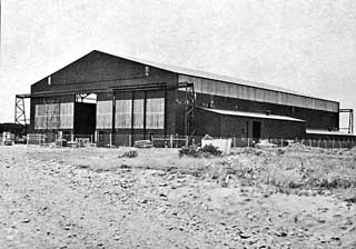
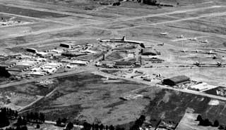
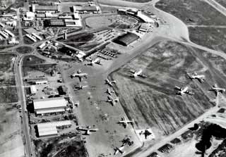
To start with, here is my January 2014 photo of the hangar, at Christchurch International Airport (also known as Harewood for the suburb in which it is located). The hangar is now used by the New York Air National Guard, and this photo shows its new NSF logo which had just been added in December. Since Operation Deep Freeze and IGY preparations began in 1955, VX-6 and the USAF occupied space at what was then known as Wigram Aerodrome in a southwest suburb of Christchurch, now closed but still the site of an Air Force museum (Christchurch libraries historical page). The commands had also been using space at Harewood and Weedons (a RNZAF stores depot southwest of Wigram). The offices had been located in a former brewery on Kilmore Street. But with the plans to continue the U.S. Antarctic program, the decision was made to consolidate the Advance Base Headquarters at Harewood. The headquarters offices and barracks were relocated in 1959 to a renovated former wartime RNZAF facility at the roundabout just outside of Harewood (photo and info). Meanwhile, this large hangar was being constructed at the airfield by Seabees from Antarctic Support Activities. It was completed in the 1959-60 season. Before looking at the hangar construction, below is a photo of Harewood in October 1957. 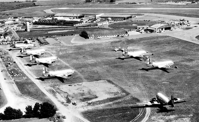 A "before" photo showing USAF C-124A Globemasters of the 53rd Troop Carrier Squadron on the tarmac in October 1957. At right top center is a VX-6 R4D-8. But I'm not sure about that USAF aircraft at lower right. Below...two 1959-60 photos showing the new hangar under construction: 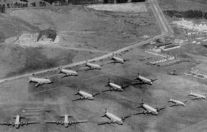 This photo, looking south, shows the hangar under construction. As many C-124A's are parked on the tarmac, this photo is probably from early season when airdrops were happening. The iconic water tower isn't visible, it is just out of the frame. 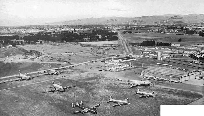 This photo is from the same angle but further back...and from later in the summer season. Note that there is no roundabout at the Memorial Avenue intersection, and that the airport perimeter has not yet been expanded to encompass the hangar. Orchard Rd. (which now runs northeast from the roundabout (on the southeast side of the hangar) has not yet been constructed. | |
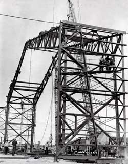 A view of the early stages of steel erection; the hangar was a prefabricated structure. |
|
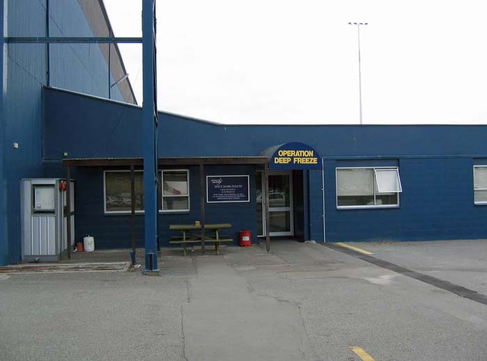 Back to the more recent past, here is my January 2004 closeup photo of the hangar pedestrian entrance. 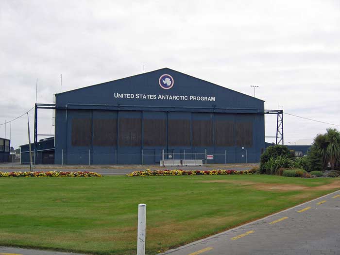
I'll finish up this page with my January 2004 photo of the hangar Be careful...on another day that January I was walking on the sidewalk across the street from the hangar carrying my camera (in my hand, in its closed case) and the hangar security guards yelled at me not to take any photos. Credits and thanks...the color photos are mine. And note that a full size version of the photo at the top of this page is available from the USAP Photo Library (link to original). Of the B&W pictures...#1 and #8 are from Gateway to the Ice by Tony Phillips, they are © V.C. Browne and Son, used by permission; #2 is from Dave Howell, #3 is from the Deep Freeze 60 winter over cruisebook; #4 is from the Christchurch Star; #5 and #6 are U.S. Navy photos from the Task Force 43 Deep Freeze 1960 cruisebook; #7 is from their Deep Freeze 1961 cruisebook; #8 is © V.C. Browne and Son, used by permission, and #9 is a markup of #8 by Joe Hawkins. | |
