Mt. Erebus Helicopter Crash, January 1971
|
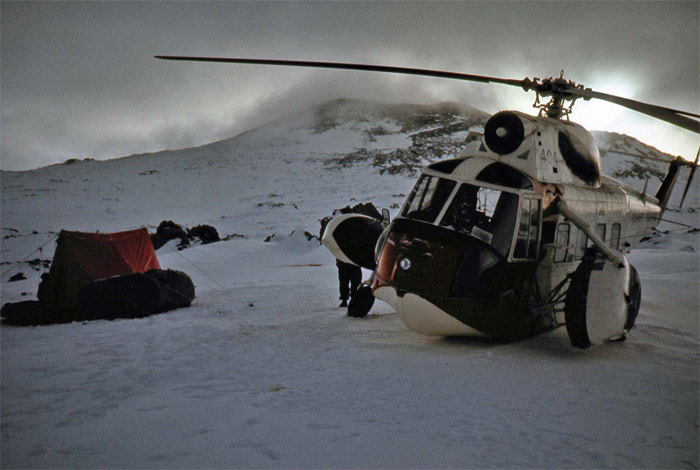
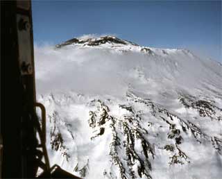
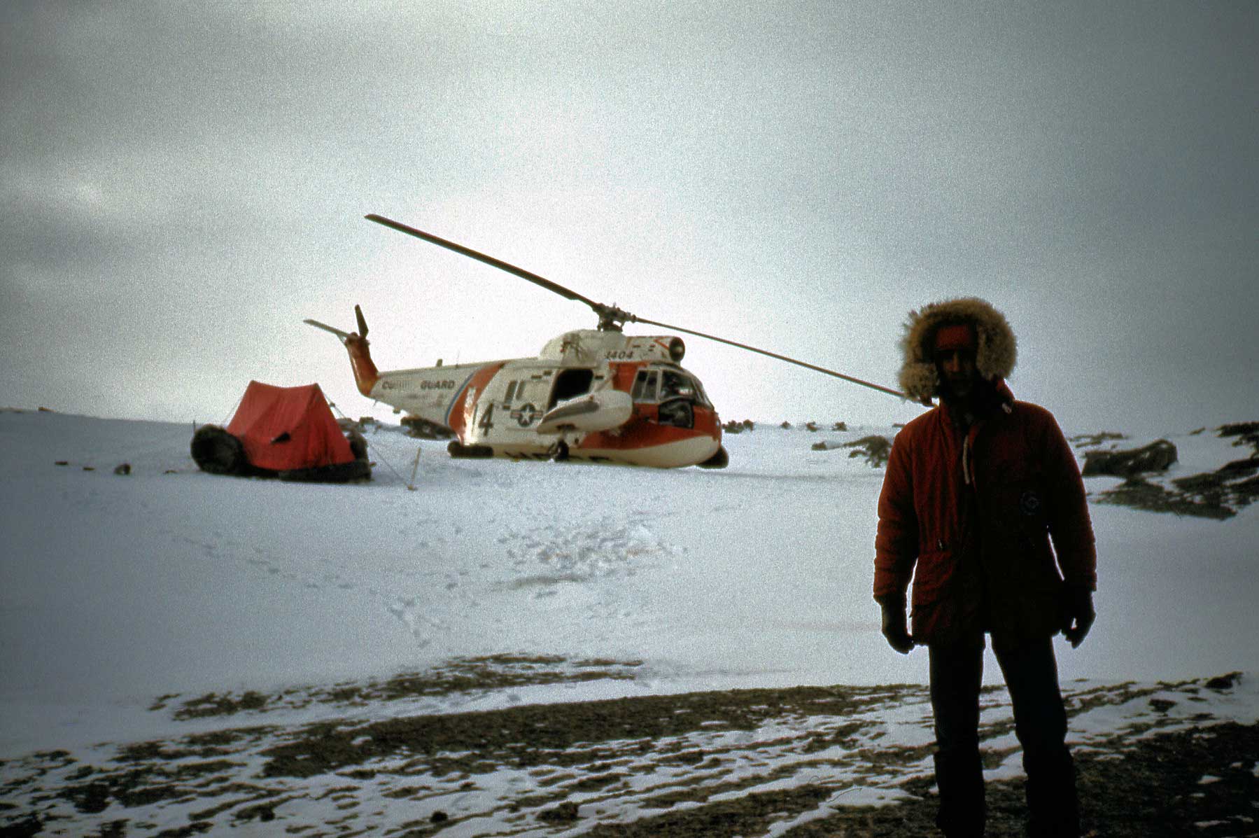
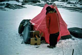
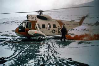
Briefly, here's the story: Charles Neider was in Antarctica on an NSF artists/writers grant, whatever they called them in those days, to gather material for what would eventually be his book Edge of the World, Ross Island, Antarctica. While in Mactown in January 1971, he wangled a visit to Cape Bird (his second, actually) during which he planned to camp adjacent to some Kiwi penguin researchers and write about the experience. The original plan was for him to be transported there by a VXE-6 H-34 helicopter, but at the last minute this ride was cancelled because there was too much cloud cover along the planned coastal route. Instead, a ride was arranged on one of the Coast Guard helo's from the Staten Island; (the HH-52A helicopter #CG1404) since these aircraft were equipped with flotation they were allowed to fly over open water unlike the Navy's aircraft. Neider had arranged with the Chalet for a GFA from the Field Party Processing Center (FPPC; renamed the BFC later that season in memory of geologist Tom Berg, who had been killed in a field helo crash the previous season) to come along on turnaround to help carry gear and set up the camp. They departed near midday on 9 January. Surprisingly, the pilot took an inland route, hugging the slopes of Erebus. He climbed to 12,500 feet, perhaps trying to fly above the crater, but the craft was too heavily loaded. Suddenly it was in a downdraft on the northwest side of the mountain; the engine could not pull up, and the helicopter crash-landed. No one was injured, but the weather was closing in and there was a shortage of survival gear. It seems that the USCG survival bags had been removed from the aircraft while it had been used for local McMurdo shuttle flights...and there were no USARP orange survival bags aboard either for some reason. Still, there was Neider's camping gear, food and tent. The group spent some time in that tent, slowly becoming cold and lamenting the lack of matches, until suddenly the two Coast Guard crew members whipped out their lighters and lit cigarettes.... The crash occurred about 1430...the brief Mayday call before the crash was not heard in McM, but an emergency call 20 minutes later was heard, this prompted an immediate SAR effort. Helos and an LC-130 went looking...at first along the presumed coastal route. Eventually the search turned to the mountain side, and at midnight one of the Coast Guard helo's spotted the crash site, tent and red flares. Survival packs were dropped, and several hours later (0245) two USCG aircraft returned to the crash site, landed, and picked up the four men. The flight and crash scene photos seen here were provided by friend Stuart Rawlinson, who was the GFA accompanying Neider (Stu would later winter at Pole in 1975 as part of the first civilian crew wintering at the new domed station). As they say, if you want the rest of the story, read the book, sort of. Neider's description of the events is quite detailed, but a large grain of salt must be taken. First, a couple of "before" pictures: | |
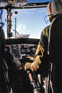 The view from the back, over the pilot's shoulder. Neider, wearing a USARP wool shirt, is in the left seat. |
|
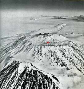
| So where was the crash exactly? Below are two official U. S. Navy photographs that Charles Neider used in his book: | |
|
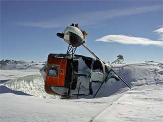
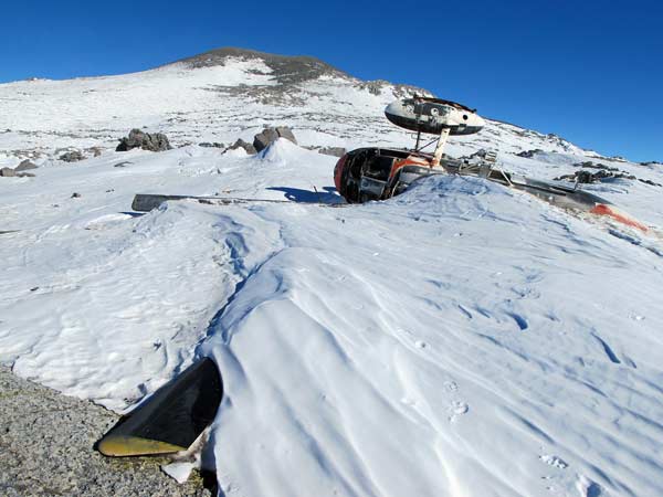
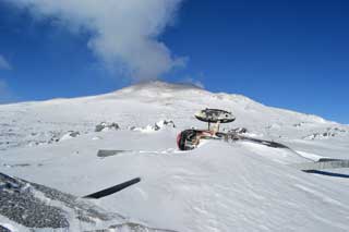
Jump ahead a bit...a year later in 1971-72 Philip Kyle made his first visit to the top of Erebus, and he reported that the helo had already been tipped over on its side by the wind. Philip was flown there in a new VXE-6 Huey helo piloted by CDR Jim Brandau, who'd been involved in the SAR operations for the crash the previous season. Oh yes, Philip Kyle is a geochemical professor from New Mexico Tech...he happens to be the preeminent Erebus researcher, 2006-07 was his 35th field season; he's had 33 field seasons on Mount Erebus. He reported that the wreck is slowly getting buried and battered. As for what this place looks like in the 21st century, now that this wreckage is, sadly, one of two aircraft wrecks left on the slope of Erebus.... 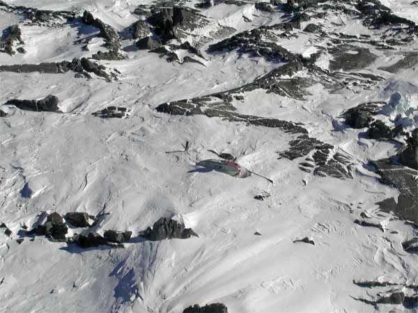 This aerial shot was taken in February 2001 by science tech friend Glenn Grant, who's visited the site a number of times. 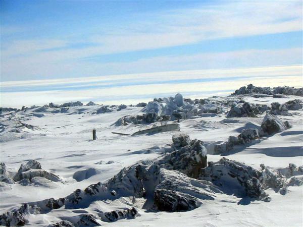 | |
|
In 2000 the crash site area was named Helo Cliffs (Wikipedia article). So where is it in relation to the huts?
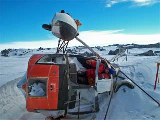
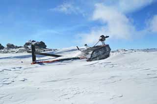
Above..a map of the summit area, from the 5-year review of ASPA 130 (pdf), presented at the 25th ATCM (Warsaw, 2002). [The protected area (the two rectangles northwest of the crater) was later redesignated as part of ASPA 175.] This area was set aside to study mosses and other growths in the steam-warmed soil. I'm guessing that the site of the helicopter crash is above the 3500 meter contour uphill/south of the Lower Erebus Hut on this map. Also note that the Upper Erebus Hut was wiped out in a storm at the beginning of the 2015-16 austral summer season, with debris scattered far and wide. Above, a newer view of the wreckage as it appeared in December 2010. This photo, from Peter Rejcek, originally appeared on the second page of this Antarctic Sun article about the volcano research on Mount Erebus. Below, two more recent photos from 24 December 2016, by NSF Artists and Writers participants Michael Carroll, and Rosaly Lopes, who spent time on Erebus and asked about this wreckage: | |
|
The wreckage will probably remain there for the significant future, given the high altitude. And of course there is also much aircraft wreckage on the slopes of Mt. Erebus from that tragic November 1979 crash of TE 901, the Air New Zealand DC-10 tourist flight. Back to history...after the crash, Stu explored the local area with one of the Coast Guard crewmen. He asserted that if necessary he could walk down to Cape Royds to seek help, and after finally meeting Stu in 2018 I firmly believe he could have done it if necessary. Neider pooh-poohed this idea saying that a deadly end in a crevasse would be inevitable. But that probably was unlikely. Remember that the first ascent of Erebus (12,447 feet) was conducted by members of Shackleton's winter party, who were, of course, staying in the hut at Cape Royds. They essentially walked straight uphill about 12 miles from the hut, and reached the crater around 10 March 1908 without encountering crevasses other than those resulting from fumaroles near the summit. In the present era the route is sometimes used (by snowmobile) by the McMurdo SAR team for training...and it was also used by ironworker Charlie Blackmer during his clandestine ascent on his day off in January 1991. The summit party from Shackleton's expedition was led by T. W. Edgeworth David, and included Dr. A. F. Mackey, Douglas Mawson, Dr. Eric Marshall, and J. B. Adams. A sixth member of the team, Philip Brocklehurst, suffered from frostbite and stayed in the tent while the rest of the group went to the rim. This first ascent is well documented (but unfortunately without a map) in Aurora Australis, a book by Shackleton, originally published by the winter party while in the hut and more recently reprinted. | |
