Sea Change in McMurdo Sound
 (above composite from the NASA Earth Observatory Image of the Day from 10 March 2011, which also provides larger images and more information) The channel opened up into Winter Quarters Bay by the Swedish icebreaker Oden precipitated a massive breakout of ice that hasn't been seen for 12+ years. At the end of February, strong winds from the south blew the ice out to sea, bringing open water lapping against the McMurdo Station and Scott Base beaches...and lots of wildlife as well. The above composite of satellite photographs shows a significant change in sea ice conditions at the south end of Hut Point Peninsula over the past few years. The first three images illustrate the significant amount of ice that obstructed access to McMurdo Station in the early years of this century...due in part to the blocking of normal ice clearing movements by iceberg B-15A (here's another NASA EOS Image of the Day from January 2002 illustrating this, with a video). The fourth photo in the composite shows what the area looked like in February 2011...with lots of open water all around the south end of the peninsula, and around past Scott Base. Is this change a result of global warming? Well, perhaps, or perhaps not. Actually, the maximum and minimum extents of breakout have not varied all that much since the beginning of the last century. When Robert Scott's Discovery Expedition sailed into Winter Quarters Bay in February 1902, they did not have any icebreaker assistance. But...a year later when the relief ship Morning showed up, Scott's expedition ship Discovery was firmly iced in. The same conditions existed a year later when Morning again showed up along with Terra Nova (the vessel Scott used on his second and more famous/disastrous expedition a few years later). In February 1904 the Discovery was still firmly iced in...major efforts with explosives were made in vain, but finally Mother Antarctica provided a wind and the ice broke up in the middle of the month, allowing all 3 vessels to head north for New Zealand. The maximum breakout usually occurs during the last week in February, although conditions dofluctuate from year to year. (Unfortunately, this time of maximum breakout is about six weeks too late to accommodate the USAP shipping season, which must start in January to facilitate resupply operations and redeployment.) The principal factors affecting the breakout are heavy swells (induced by a storm in the Ross Sea) followed by strong winds from the south. And in some recent years, the breakout has been hindered by blockage from the large icebergs that calved from the Ross Ice Shelf. But in any case, if Scott had anchored his ship in Winter Quarters Bay in 1998, it would have been firmly iced in until 2011. Below, some documentation: | ||
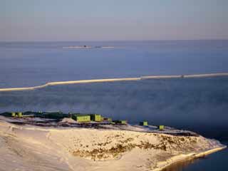 Here's a 26 February 2011 view from Observation Hill looking southeast past Scott Base, showing the open water, a bit of ice fog, and the LDB (Long Duration Balloon) facilities in the distance (Jeff Scanniello, Antarctic Photo Library). |
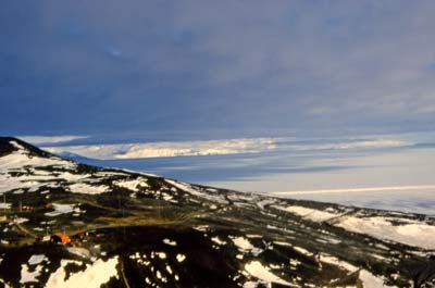
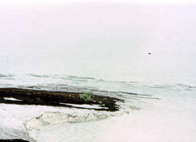 By comparison, here's my January 1977 photo from the same vantage point (in poorer visiblity conditions). All is ice, of course, but a pressure ridges are visible, as well as a breakout line between annual and multi-year ice. Beyond the breakout line is the road to Williams Field, on which a vehicle is visible. | |
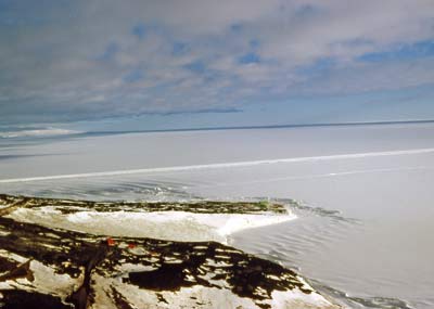
| Going back another few years, the above photos I took in December 1972 show the road through the Gap past T-site...the Cosray building...and Scott Base. The bright white line across the ice shelf is the 1972-73 ice road to Williams Field, and again, a breakout line can be seen on the west side of the road. Here's another piece of documentation that the ice sometimes breaks out around past Cape Armitage even before global warming had become an issue. This clip from the 1970 revision of the USGS map of Ross Island shows a February 1965 ice edge approximately where it was in February 2011. Not so earlier in the season in the IGY era, when it took a lot of icebreaker work to get close to the site of McMurdo Station...and Hillary's team had to drive across 9 miles of ice to reach Pram Point and establish Scott Base. | ||
| Going back a few more years...above is a 23 February 1962 photo of Cape Armitage looking roughly northwest; McMurdo and Hut Point are in the center background, and Scott Base is off the right side of the image. The map at left indicates the ice breakout lines between 1956 and 1962...also note the route of the Scott Base road during that era--crossing a bit of bay ice. Onshore remnants of that road are still visible today. | ||
|
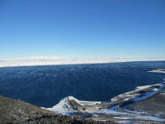
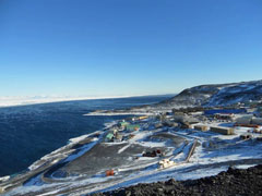
The above map and photo are from a 1963 paper by A. J. Heine, Antarctic Division, Department of Scientific and Industrial Research, Wellington, New Zealand; titled "Ice Breakout Around the Southern End of Ross Island, Antarctica;" published in the New Zealand Journal of Geology and Geophysics, Vol. 6, No. 3, June 1963. The full article (as well as the rest of the "Second Special Antarctic Issue" of the journal) is available here. Back to 2011...first, more photos (these are courtesy of Al Martin): | ||
| ||
