Views From Ob Hill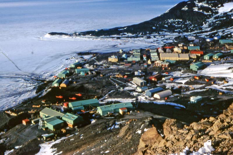 The above view is from my December 1972 visit. The nuclear plant is in the foreground. Building 155 is shiny and new as is the Hotel California in the center near the Chalet. Notice all of the dorms that are not there... 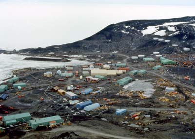 Here's a similar view from January 1977 while I was on R&R from Pole.  Here's the view in 1977 with a zoom lens. Now we have Silver City just behind building 155, and a brand new Mammoth Mountain Inn (MMI) still under construction, but still no uppercase dorms in sight!  This is almost the same view (unzoomed) eleven years later in January, 1988. In the center of the picture above the chalet, the foundation pad has been completed for the first part of the Crary lab. Behind that, the 200 series dorms through 208 have been completed. At the far upper right, the new heavy shop is 98% complete. In front of the icebreaker are the present-day power and water plant buildings. In the foreground is the "old water plant" which was left over from the nuclear plant days. These structures housed backup water distillation units and storage tanks which remained for a few more years. The flat graded area to the right of the water plant shows where the "hot" portions of the nuclear plant (and the surrounding soil/rock) were removed and shipped back to the US. 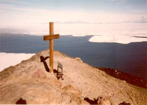 The cross is not at the top of Ob Hill since in 1913 it was not possible for the surviving members of Scott's expedition to drill into solid rock!! This is a view from the summit of the hill looking south at the cross (1/88) with White Island in the background. In the foreground somewhere is the rock I set my camera on in 1977, so I could use the self-timer to shoot my hero shot you see on the previous page... 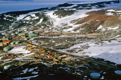 The next four pictures were taken in December 1972. This view is looking northwest across the upper part of town. This area was a bit more snow-covered for this time of year than it seems to be more recently. Of course, the snow is colored gray/brown from windswept dust and dirt. The hills behind McMurdo were regularly "scraped" to break loose the unfrozen surface layer of gravel for use in road building.
In 1972 there was cargo stacked EVERYWHERE. One of the problems with the Navy supply system at this station (and the other IGY sites) in the early years was that it was based on an "invasion" philosophy where the same large quantities of stuff was shipped in each year with little regard to the quantity on hand (which often was unknown) or the real requirements. Similarly, new vehicles and equipment showed up each year instead of spare parts to fix the existing equipment. The Navy was working to rectify this situation, but it would take awhile yet. The large green structure in the left center of this picture is the "Public Works Garage" or what we might call the "heavy shop". On 1 December 1981 it burned down. The fire started in the metal shop, and it spread quickly because instead of a concrete floor, the structure had a subfloor of heavy timbers covered with steel checker plate. The wood eventually got soaked with oils and solvents, and when the fire started, it spread quickly. The brown structure to the left was the Navy's Public Works office and shop building; it is presently used for office space. Here's another view of the general area looking a bit further north. 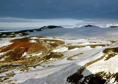 This view is more to the north, looking across the Fortress Rocks area. The road to Arrival Heights winds across the plateau behind the hills. The rocky areas here would see some extensive quarrying in later years when the demands for gravel for construction and landfill operations exceeded the supply available from scraping the hillsides. 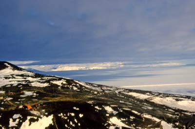 Now I look northeast at the road through the Gap behind Ob Hill. On the left are the structures and antennas of the transmitter site. The straight line across the ice shelf is the road to the ice runway and Willy Field. 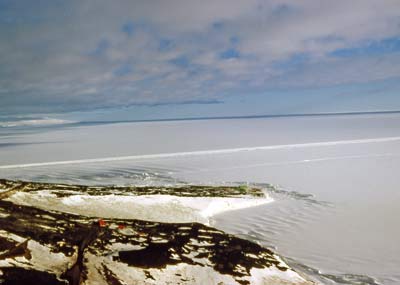 A view a bit more to east showing Pram Point where Scott Base is visible. The red structure in the center is the cosray lab, built here so its cosmic ray detectors would be shielded by Ob Hill from the radiation of the nuclear plant on the other side. The prominently visible berm running across the ice is the road to Williams Field; between it and Scott Base can be seen a demarcation line between annual and multiyear ice. 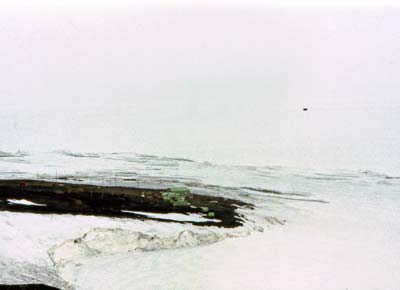 Here's a January 1977 zoomed view looking toward Scott Base (yes, this slide hasn't survived as well as some others). The breakout line between the annual an multiyear ice is in about the same place, while pressure ridges are more prominently visible. A vehicle on the road to Williams Field can be seen in the distance. |