McMurdo in 1960-61
|
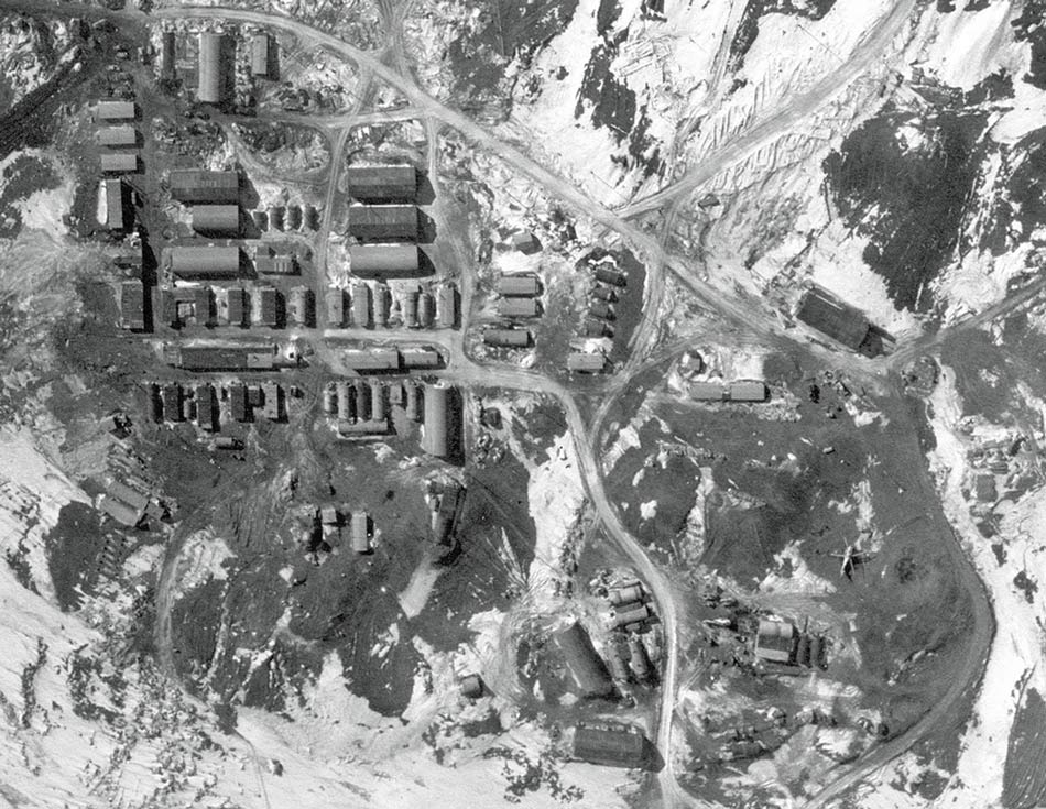
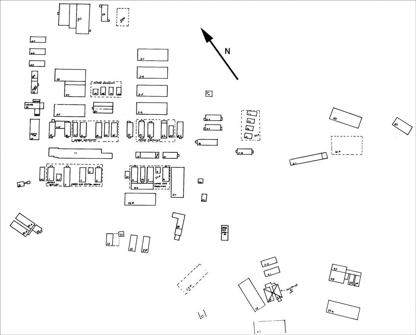
Explanations and credit...first, I must point out that the photos on this page are significantly larger in file size than what I normally post. More significantly, everything seen on this page is from the late Bruce Raymond, a friend who wintered at McMurdo in 1960-61 as a photographer's mate. He shared several CDs of official Navy photos with me...some taken by him, others, such as the above photo, presumably taken by others. I've cropped and edited this photo (for contrast only) to align with the photo below, which is a detailed map identifying all of the buildings seen here. Here's the full size original (unrotated) photo that this was cropped from, note all of the aircraft parked close to the station on the sea ice. | |
|
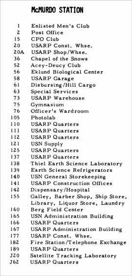
Above, the 1960-61 station map and legend. This was based on the end of the summer season...so the VX-6 parachute loft and avionics shop Quonset huts "destroyed by fire" during the summer appear in the photo at the top of this page, and a few other structures depicted on the map (such as the cosray lab and the Quonset hut warehouse S7) do not appear in the above photo. I've tried to clean it up as well as add an approximate north arrow. For detailed perusing I recommend that you open each of the above images in a separate tab or window.
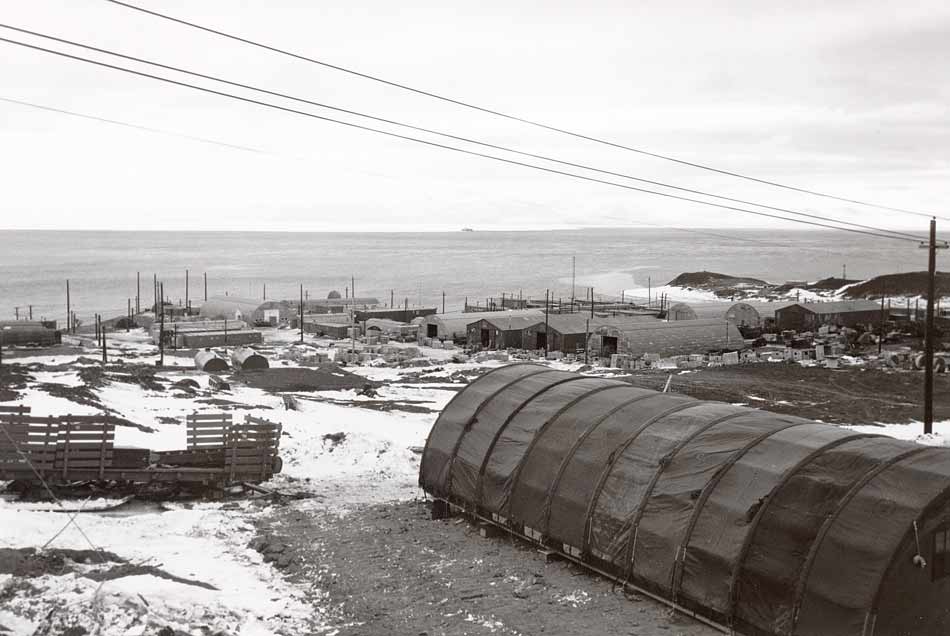 Looking roughly northeast from above the station, and at a newly erected (and not ID'd on the map) Jamesway. This photo shows all 4 of the warehouses, including the new Quonset hut uphill from the two Butler buildings. 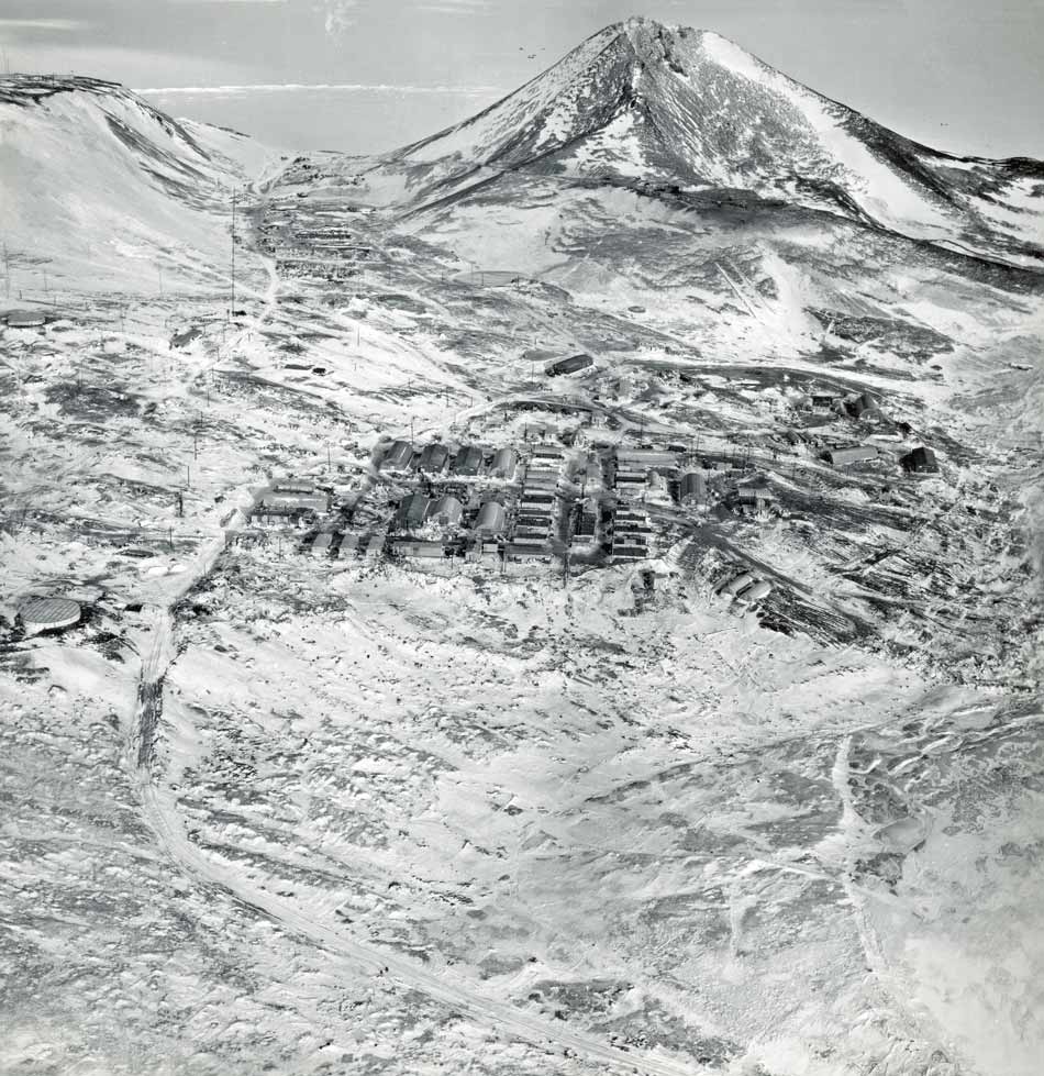 Another overall aerial view of McMurdo at the end of the 1960-61 summer, looking southwest toward the Pass and Observation Hill. In this photo, all 4 of the warehouses seen behind the Jamesway in the previous photo are visible. And the original cosray lab is visible at the bottom of the hill, directly below the cross. | |
| For comparison, I'll finish this page with the 1976 McMurdo map from the booklet Your Stay at McMurdo Station Antarctica 1976-1977, which has been rotated to align with the photo and map at the top of the page. Unfortunately it does not list all of the building numbers, but it gives a good idea of how the station evolved over the years. As expected, none of the "proposed" structures on the earlier map actually happened as depicted, and the 4 large warehouses near the center of town disappeared to make way for Building 155. | |
